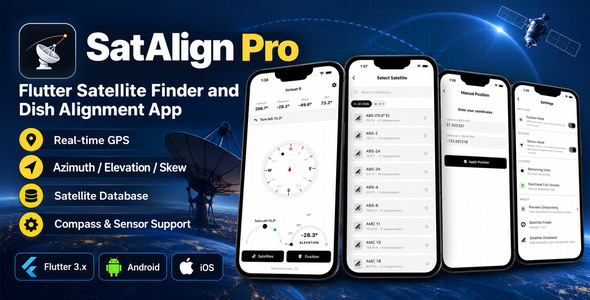
SatAlign Pro – Flutter Satellite Finder and Dish Alignment App is a mobile application template designed to help developers build a satellite discovery and satellite dish alignment utility. Built with Flutter, SatAlign Pro provides a foundation for creating an application that helps users identify satellite positions, understand dish orientation requirements, and access useful information when setting up satellite television or communication equipment.
Accurately aligning a satellite dish requires understanding several technical parameters, including azimuth, elevation, and LNB skew. For installers, technicians, and satellite TV enthusiasts, a mobile application can make these calculations easier to access while working at a residential or commercial installation site.
SatAlign Pro is a potential starting point for developers who want to create a practical satellite alignment tool with a customizable mobile interface. Its suitability for a particular project depends on the features included in the original package, the supported satellite data sources, and any additional integrations required.
The primary purpose of a satellite finder application is to help users determine the direction in which a satellite dish should point. SatAlign Pro can serve as a foundation for presenting satellite information and alignment guidance through a mobile interface.
Depending on the supplied implementation, the application may be adaptable to display selected satellite positions, dish orientation values, and related setup information. These details can help users understand the initial alignment requirements before fine-tuning the dish using a compatible satellite receiver or signal meter.
Potential use cases include installing satellite television equipment, adjusting an existing dish, planning an antenna installation, and assisting technicians during field service visits.
The exact alignment tools and calculations available in the template should be verified against its original demonstration and documentation.
Flutter provides a cross-platform development framework that allows developers to build applications for supported platforms using a shared codebase. SatAlign Pro uses Flutter as its mobile application foundation, making it a potential starting point for creating a consistent satellite utility experience.
Using an existing template can reduce repetitive interface development and help developers focus on adapting the calculations, satellite information, and device integrations required by their project.
Potential development benefits include:
Supported operating systems, Flutter versions, and device compatibility should be confirmed in the supplied technical documentation.
A satellite finder application needs reliable information about the satellites users want to locate. A structured satellite catalog can help users select the appropriate target and review its orbital position.
Depending on the included implementation, SatAlign Pro may be adaptable to display satellite names, orbital longitude, service information, or other relevant metadata.
Potential catalog features include:
The availability of these features depends on the original implementation. Developers should verify whether the application includes a built-in satellite database, uses an external data source, or requires manual configuration.
Satellite information should also be maintained appropriately because inaccurate or outdated records can lead to incorrect alignment calculations.
Three important parameters commonly used when aligning a satellite dish are azimuth, elevation, and LNB skew.
Azimuth describes the horizontal direction in which the dish should point. The precise direction depends on the user’s location and the target satellite’s orbital position.
Elevation describes the vertical angle of the dish relative to the local horizon. Correct elevation helps the antenna point toward the satellite rather than above or below its required direction.
LNB skew refers to the rotation of the low-noise block converter to match the satellite signal’s polarization. Correct skew can help improve signal reception.
SatAlign Pro can be evaluated as a foundation for displaying these parameters or implementing the associated calculations, depending on the supplied features.
Accurate results require valid satellite coordinates, the user’s geographic location, and a clearly defined angle convention. Developers should test calculations against established reference tools and account for regional differences in how compass directions and skew angles are presented.
A user’s geographic location is an important input for calculating satellite dish orientation. A location-aware application can use device location services to help determine the appropriate direction and elevation for a selected satellite.
Depending on the existing implementation, SatAlign Pro may be adaptable to use GPS coordinates or allow users to enter a location manually.
Potential location-related features include:
GPS accuracy varies according to device hardware, environmental conditions, and the availability of satellite signals. Users should have an alternative when location detection is unavailable or inaccurate.
Location data should be requested only when necessary, with clear explanations of why it is needed.
A mobile device’s compass can provide directional information that may help users orient a satellite dish. Combined with alignment calculations, a compass-based interface can make it easier to understand the required pointing direction.
Depending on the supported features and device hardware, SatAlign Pro may be extended with compass readings, directional indicators, or sensor-assisted alignment guidance.
However, a phone’s compass is not a precision satellite signal meter. Its readings can be affected by magnetic interference from metal structures, mounting equipment, electrical devices, and nearby vehicles.
For reliable use, the application should communicate calibration guidance and allow users to verify the direction independently when necessary. Some devices may not provide all required sensors, so hardware compatibility should be checked.
A map interface can help users understand their installation location and visualize the relationship between their position and the intended satellite direction.
If map integration is included or added, SatAlign Pro could be customized to display a user’s location, an orientation line, or other geographic references that support dish installation.
Possible enhancements include a satellite direction overlay, manual location selection, map zoom controls, and a geographic reference view.
These features require an appropriate mapping service and, where applicable, a valid API key. Map-based visualizations are supplementary guidance and should not be treated as a replacement for accurate alignment calculations or signal measurements.
Augmented reality can potentially make satellite alignment easier by combining device orientation with visual guidance on the camera view. This can help users understand the general direction in which the antenna should be pointed.
Depending on the template’s capabilities and additional development, SatAlign Pro could be extended with a visual direction indicator or an augmented-reality interface.
Such functionality may require additional libraries, camera permissions, compatible device sensors, and careful calibration. It should not be assumed to be included in the original product unless explicitly listed in its documentation.
Developers should also account for sensor limitations and ensure that visual overlays remain clearly distinguishable from actual measurements.
A satellite utility benefits from an interface that presents technical values clearly without overwhelming users with unnecessary information.
SatAlign Pro can be evaluated as a starting point for customizing the presentation of satellite details, orientation values, device readings, and installation guidance.
Potential customization areas include:
The exact customization options depend on the supplied source code and UI components. Developers should also test the interface across supported screen sizes and device configurations.
Calculating the correct pointing direction is only part of the dish installation process. Final alignment usually involves monitoring the received signal and making small adjustments to the dish.
A mobile application may provide directional guidance, but actual signal strength and signal quality generally need to come from a compatible receiver, meter, or supported hardware integration.
If the original implementation does not include signal monitoring, developers could explore integration with compatible equipment where suitable APIs or communication protocols are available.
Potential extensions include signal-quality displays, alignment checklists, installation notes, and saved setup information. These features require appropriate hardware or software support and should not be advertised as existing functionality without verification.
A reliable satellite alignment application should handle location permissions, sensor availability, changing GPS accuracy, and calculation errors appropriately.
Developers should test the application under different conditions, including indoor and outdoor use, weak location signals, compass interference, and devices with different sensor configurations.
Calculations should be validated using known coordinates and satellite positions. Error messages should explain when a result cannot be calculated reliably, and the interface should distinguish calculated alignment values from actual signal measurements.
The final performance and compatibility depend on the supplied code, device hardware, data sources, and any additional services integrated into the application.
SatAlign Pro may be suitable for:
Before selecting the template, review its technical requirements, included features, licensing terms, source code, and supported device capabilities.
SatAlign Pro – Flutter Satellite Finder and Dish Alignment App provides a foundation for developing a mobile utility focused on satellite information and dish orientation. Its Flutter-based structure can be adapted to present satellite data, calculate alignment parameters, and potentially integrate location services, device sensors, mapping tools, and other installation-related capabilities.
The exact functionality depends on the original implementation and the integrations available for the intended project. Developers should verify the included features and test the alignment calculations before deploying the application for real-world installations.
With accurate satellite data, appropriate sensor handling, a clear user interface, and validation against reliable reference measurements, SatAlign Pro can serve as a starting point for a useful satellite finder and dish alignment solution.
1. All digital products are the most recent version, with no possibility of free updates. After payment, you can request an update to the most recent version for 5 days if a new version is released. We free support within 5 days.
2. If a license is required (Excludes WHMCS license , we provide only method not license), please contact us via email or ticket for assistance with activation. Our license is only valid for activation and does not include support.
3. We provide Mobile, PHP script installation services for $19.90 / ₹1700. Please create a backup after installation as we do not support re-installation. For mobile app source code, we do not offer installation services.
4. If you have any questions, please contact us by email [email protected] or create a ticket on this page
5. Please note that any digital products presented on the website do not contain malicious code, viruses or advertising. You will receive the original files from the developers. We do not sell any products that have been downloaded from other websites.
6. The response time can last up to 6 hours.

Eaterny | Food Delivery and Restaurant Flutter App UI Template Eaterny | Food Delivery and Restaurant Flutter App UI Template is a...
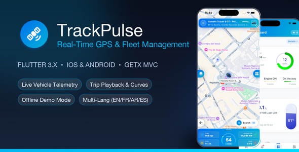
TrackPulse | Real-Time GPS Tracking and Fleet Management App (iOS and Android) TrackPulse | Real-Time GPS Tracking and Fleet Management App (iOS...
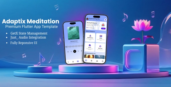
Adaptix Meditation | Flutter app Template Adaptix Meditation | Flutter app Template is a modern mobile application design solution created for meditation...

Tidewell | Flutter Doctor Appointment App With Live Wait Tidewell | Flutter Doctor Appointment App With Live Wait is a modern healthcare...
